|
|
|

|
25.3
°C
 77 °F
77 °F
---
Feels like:
30
24-hr difference
-8.1°C
|
|
24 HOUR TEMP TREND
|
| |
Today |
Yesterday |
| High: |
27.2°C
2:29pm |
35.3°C
4:18pm |
| Low: |
19.8°C
5:25am |
19.7°C
5:22am |
| Max Hmdx: |
37 |
|
| |
High |
Low |
| Month: |
35.3°C
on the 12th
|
10.9°C
on the 2nd |
| Year: |
35.3°C
on Jul 12th
|
-35.0°C
on Jan 25th
|
| All Time: |
41.0°C
Aug 11,2018
|
-40.8°C
Jan 28,2004 |
| |
| AirlinkData: |
Temp26.8°C
|
Humidity52%
|
| 2nd ISSData: |
Temp25.4°C
|
Humidity56%
|
| TempestData: |
Temp0°C
|
Humidity0%
|
|
|
|
Current Gust:
6.4 km/h
2 Bft -
Light Breeze
|
|
Gust Last Hr:
23 kmh ESE
|
|
Avg. Last Hr:
10.3
|
|
Gust Today:
29.6 km/h
12:20am
|
|
Gust Month: 40 km/h July 3
|
|
Tempest Wind Data
Current: 0 at 0 km/h
Gust Today: 0 km/h |
|
|
|
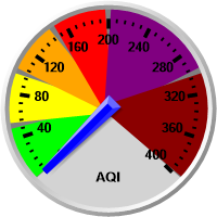
Air Quality Data
|
|
|
|
| Rain Today: |
0.0 mm
|
| Rain Today: |
0.00 in.
|
| Rain Rate (/hr): |
0.00 mm
|
| Rain Prev Hour: |
0.0 mm
|
| Rain Prev 6 Hrs: |
0.0 mm
|
| Rain Yesterday: |
0.0 mm
|
| Rain Prev Week: |
6.1 mm
|
| This Month:
x̄=49.2 |
11.9 mm
|
| Rain Month: |
0.47 in.
|
| This Year: |
267.9 mm
|
|
5 days of rain in July. |
|
|
|
|
|
Tonight

A few clouds
Min: 18°C
Tue, 14 Jul

A mix of sun and cloud
Max: 28°C
Night

Cloudy
Min: 18°C
Wed, 15 Jul

Chance of showers
Max: 24°C
|
|